Geospatial Team: Our Spring In Review
Recap of Events and Workshops
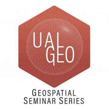
Looking back at the spring semester, it was a busy and successful period of collaboration and learning. The geospatial team at the library completed two large event series. The first was the Geospatial Seminar Series, which brought speakers from the broader GIS community to present at the University of Arizona.
AZGeo kicked off the series, providing tips and tricks for users to get the most out of the modernized state geospatial clearinghouse, AZGeo. Topics included searching, downloading and uploading, creating metadata, best practices for data tagging, content organization, and connecting to ArcGIS Pro. AZGeo is a powerful GIS tool here in Arizona, and we are lucky to collaborate with them here at the library.
OpenStreetMap US Executive Director Maggie Cawley gave the next seminar, providing a history and overview of the OpenStreetMap project and highlighting ways to engage with the project by contributing and editing or utilizing the database in research. The seminar was a great way to learn about OpenStreetMap ahead of the University hosting the national State of the Map conference in the spring.
The City of Tucson GIS team also hosted a great seminar, providing insight into the City of Tucson's use of GIS to address some of the city's most important concerns, including climate change and the housing affordability crisis. Participants learned how the city uses GIS data and technology to engage the community in planning efforts and support anti-gentrification coalitions. It was an opportunity to hear about the latest projects that the City of Tucson is working on, ask questions about the City GIS program, and learn about the impactful role of GIS in local government.
Jim Herries finished the series, presenting a seminar on ESRI Living Atlas and how an hour with the atlas may save weeks of time. ArcGIS includes ready-to-use content available in ArcGIS Living Atlas of the World. It is the foremost collection of worldwide geographic information, containing layers, maps, apps, and much more from Esri, our partners, distributors, and the global GIS community - it is very much a Living Atlas. The content is curated, authoritative, and continually updated. In this hands-on session, participants were encouraged to search and try things out during the session. Try it out for yourself!
The geospatial team also hosted a StoryMaps Workshop Series, a three-part series aimed at improving digital storytelling and StoryMap accessibility at the University of Arizona.
The series kicked off with our "Introduction to ArcGIS StoryMaps" workshop, conducted in collaboration with Digital Borderlands. ArcGIS StoryMaps allows for weaving an inspiring and interactive narrative by combining text, maps, and multimedia content – images, videos and embeds – to communicate information through engaging and user-friendly web mapping applications. The workshop covered how to share stories uncovered through research and make them accessible to a broader audience. The workshop materials are available here.
Part two of the workshop was "Level Up Your StoryMaps." Attendees learned the basics of ArcGIS Online to introduce unique and custom map elements into StoryMaps. The workshop covered advanced StoryMap creation tips and tricks to allow for completing projects at a professional level. Skills presented include combining text with maps, multimedia content, images, videos, and embeds – to communicate information through engaging and user-friendly StoryMaps. The workshop materials are available here.
We were lucky to have Carl Churchill of Woodwell Climate Research Center complete our StoryMap series with "StoryMaps for Communicating Research." This presentation shared why StoryMaps are a helpful tool and how to plan and execute a complex one in a team setting. Carl is a cartographer, and the seminar touched on cartographic theory, design, and good practices for working on the web.
The final stage of the StoryMaps Workshop Series was creating a space where students and researchers could share their stories. The new Library Geospatial Hub is a space where StoryMaps can be showcased and presented to the public.
We would like to thank all those that presented and attended Library Geospatial events this past spring. Next year we hope to continue to make geospatial tools accessible to the campus community and provide workshops and events that enable students and staff to share their stories.